
Trace a Wisconsin Street Address
For a Wisconsin street search, first pin down the city, village, town, and county. Then move from the physical address to a parcel, from the parcel to an owner record, and from that record to other evidence. No single source proves who lives at every door. The Wisconsin Statewide Parcel Map is a useful first pass, but the local assessor and county Register of Deeds hold the records behind its map. A street that crosses a boundary may need separate searches on each side.
- Enter the house number and street in the Wisconsin municipality's assessor search. Save the parcel number, owner name, legal description, and assessment year.
- Open the Wisconsin Statewide Parcel Map, find the street, and select each parcel. Compare site and mailing addresses, then follow a local source link when available.
- Use the parcel ID, legal description, or current owner's name to locate the transfer in the Wisconsin county deed index. Work backward by grantor and grantee if earlier title is needed.
- For election context, use MyVote for a specific self-check or ask the Wisconsin Elections Commission about a written request for allowed, nonprotected voter-list fields.
- For an earlier household, ask a Wisconsin public library or archive about address-browse directories, local tax rolls, plats, and map collections for the right year.
For a Wisconsin street directory search, keep the source date and exact address string at each step. A parcel owner, a registered voter, and a person printed in a directory are different kinds of evidence, not interchangeable names on a street list.
Wisconsin Street Records by Address
Address records in Wisconsin sit with several custodians. The local assessment office identifies the parcel and tax record; county land-information staff maintain map layers; the Register of Deeds records instruments; municipal departments keep permit and code files. MyVote handles an individual's registration check and address-based election information, while libraries and the Wisconsin Historical Society preserve older address directories and maps. The access route changes by record and county.
| Record keeper | Address evidence | Online route | Other access |
|---|---|---|---|
| Wisconsin municipal assessor and treasurer | Parcel owner, value, tax key, site and mailing address | Wisconsin local assessor or county land-information portal | Ask the Wisconsin custodian for a card or tax record; formats vary |
| Wisconsin county land-information office | Parcel geometry, roads, legal-description context, map layers | Wisconsin county GIS or statewide parcel viewer | Use the Wisconsin local office when map data is stale or incomplete |
| County Register of Deeds in Wisconsin | Recorded transfer, lien, plat, easement, and party roles | County search, Tapestry EON, or Laredo where offered | Counter, digital reel, deed book, or microfilm by county |
| Wisconsin election custodian | Limited registration and election information | MyVote individual check and address election lookup | Written WEC or local clerk request, with protected fields withheld |
| Wisconsin municipal building or code office | Permit, inspection, or case event tied to an address | Some city portals; no statewide index | Records request or office contact; redactions can apply |
| Wisconsin library, WHS, or regional archive | Past occupants, street maps, plats, tax rolls, local context | Digitized catalog or collection pages where available | In-person research, staff help, microfilm, or interlibrary transfer |
Wisconsin's Public Records Law, Wis. Stat. §§ 19.31-.39, sets the request framework but does not create one shared street-search portal. Describe the address, parcel, record type, and year when asking an office for a record. An index result helps locate a file; an official copy comes from its custodian.
Note: Address records sit with different custodians, so a missing online result may still be available by request, at a counter, or in a library collection.
Wisconsin Street Numbers Change
In Wisconsin, street numbers are local records, not fixed statewide coordinates. Madison's 1883-84 directory explains its own system: lake-to-lake streets count from Lake Monona, while northeast and southwest streets count from Wisconsin Avenue, except Main and Wilson, which count from the railroad. Those rules describe that historic grid, not every Wisconsin address.
Milwaukee's 1930 Address Change Directory provides another Wisconsin bridge for old house numbers, and it includes Wauwatosa street-name changes from 1931. Annexations, new subdivisions, road renaming, rural-route changes, and 911 readdressing can all alter the printed address. If an older record seems to point to the wrong block, check a contemporary directory, plat, Sanborn map, or Wisconsin municipal address-change source before treating it as a different property.
Three Wisconsin Address Fields
Parcel records can show a street location, a separate postal destination, and a legal description. Wisconsin's statewide V12 parcel schema retains these local fields, though the data may be older than the current municipal card. Its earlier project reports said 82 percent of Wisconsin counties did not maintain ZIP codes for site addresses, so a blank site ZIP is not proof that the property lacks mail service.
- Situs or site address
- The address of the physical land or building. Wisconsin's parcel schema labels the full physical address SITEADDRESS.
- Owner mailing address
- The address where tax or other owner mail is sent. PSTLADDRESS may point to a post office box, agent, or another place.
- Parcel
- A unit of land tracked for assessment and mapping. One parcel can include more than one structure or unit.
- Plat and legal description
- A recorded map or written land description that can identify a lot, block, subdivision, or rural parcel beyond its street number.
- Criss-cross directory
- A reverse city directory arranged by address, so a researcher can look from a street location to a printed name for that year.
Keep each label tied to its record source. Site address, tax-mail destination, USPS last line, and legal description can differ for the same land.
Wisconsin Assessor Search Fields
Wisconsin has no single public assessor form. Wisconsin municipalities choose which local portal fields are searchable, and the Wisconsin Department of Revenue assessor directory routes a searcher to the municipality that keeps the assessment record. Madison's city form is a useful concrete example: it offers address, address-range, owner-last-name, and parcel-number paths. Its address search asks for a house number and street name, with other components available to narrow or match the address.
The Madison assessor page shows its address and owner search modes.
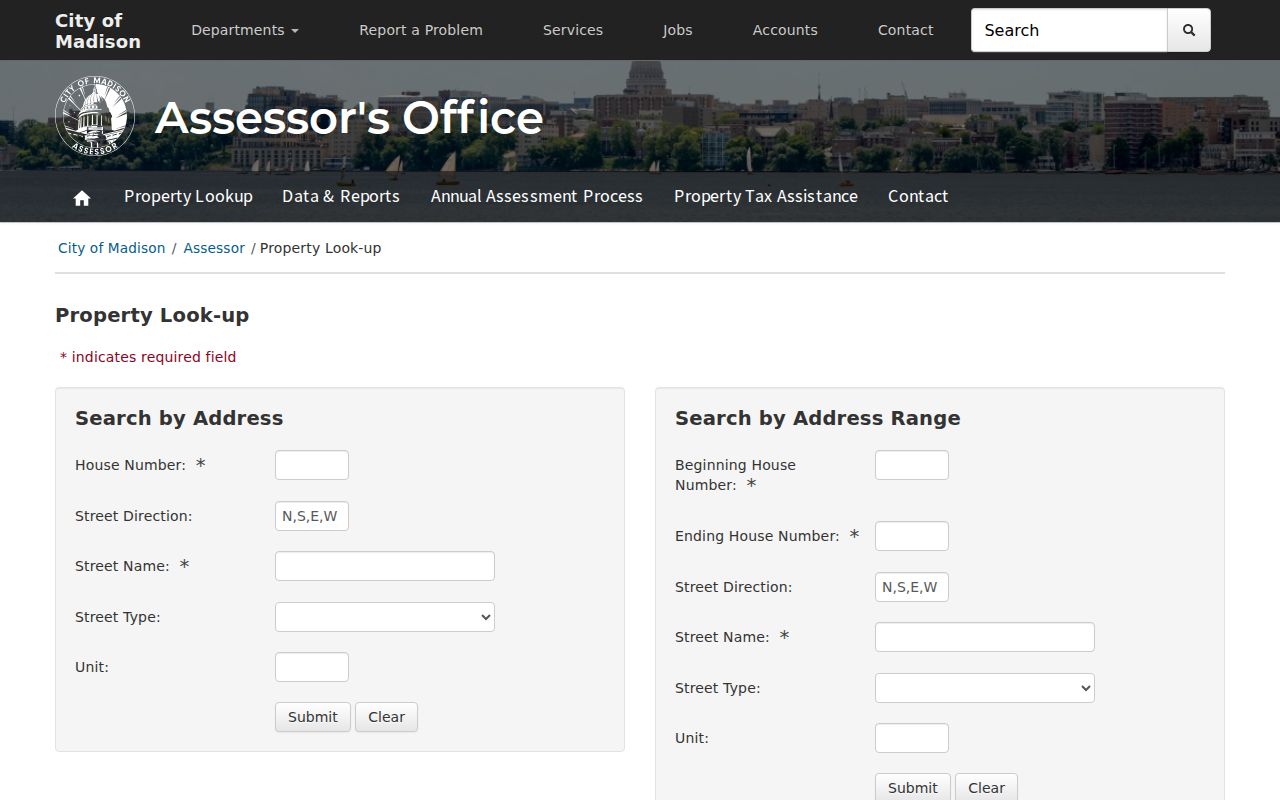
Use the visible field options as a prompt to inspect the assessor for the correct Wisconsin municipality, since nearby places may use different search tabs.
| Wisconsin portal field or mode | Type | Need it? | How it helps |
|---|---|---|---|
| House number and street name | Text | Required for Madison address mode | Finds the parcel by its physical location |
| Street direction and type | Text or selection | Optional where offered | Separates similar streets and normalizes suffixes |
| Unit | Text | Optional | Distinguishes an apartment or condominium address where the form supports it |
| Address range | Range fields | Alternate Madison mode | Searches a span of street numbers instead of one parcel |
| Owner's last name | Text | Alternate mode | Madison permits full or partial names; other portals differ |
| Parcel number or tax key | Text | Alternate mode | Connects the card to GIS and deeds |
| Wisconsin county or municipality | Selection | Often needed | Prevents a same-name street from landing in the wrong jurisdiction |
| Tax or assessment year | Year choice | Optional when shown | Dates values and owner details that can lag the present |
| GIS address or location search | Text | Optional map search | Moves the map to a street segment or place |
| GIS parcel identify | Map selection | No typed field | Opens parcel ID, owner, site, and mailing attributes when submitted |
| GIS layer list and adjacent parcel click | Map controls | Optional | Shows roads or other enabled context and lets the researcher move across touching polygons |
| Wisconsin MyVote name fields | First name, last name, birth date | All required for name path | Checks an individual's own registration record |
| Wisconsin MyVote address fields | Street, unit, city, ZIP | Shown as required | Finds election and polling information for the location, not names at the address |
The assessor step in a Wisconsin street directory search may be free online yet still require a phone, email, mail, or counter request for older cards or a corrected record. Madison is a municipal example rather than a statewide service promise. If a local site lacks an address form, the Department of Revenue's assessor directory can help identify the right Wisconsin office.
Note: Madison shows real assessor modes, but its search tabs and assessment year are not a statewide promise for other municipalities.
Browse Parcels Along Wisconsin Streets
The Wisconsin State Cartographer's Office parcel-data page explains that statewide V12 aggregates local submissions and should be checked against a newer local source. The associated parcel viewer lets a researcher search or browse a location, select a parcel, inspect an identify pop-up, switch visible layers, and follow a county or download link when available.
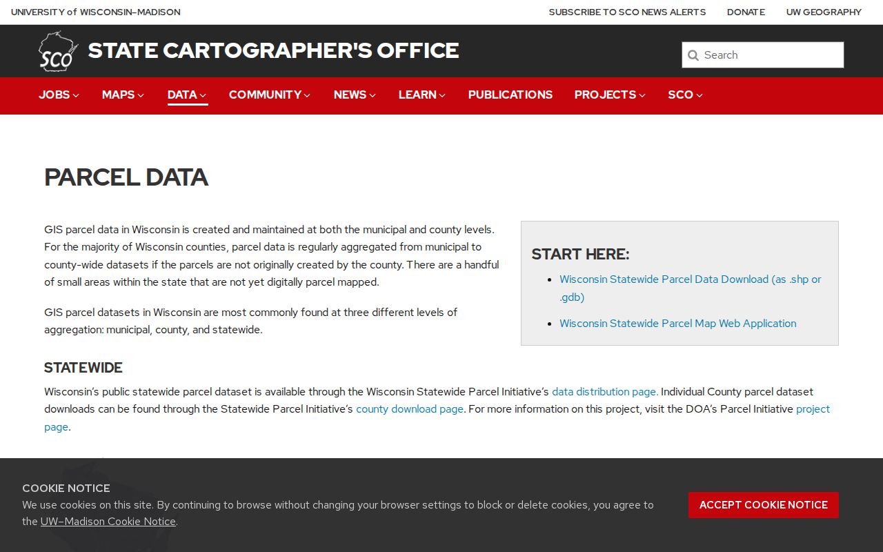
This screen is a starting point for a street walk, not a title certificate. Click parcel by parcel, save the local identifier, and use a municipal assessor when the statewide map lacks a site address or current detail.
The V12 parcel feature-service record describes fields that can include primary and secondary owner, full mailing and site addresses, parsed street and unit parts, municipality, parcel ID, geometry, legal-description data, and ZIP or ZIP+4. The Wisconsin layer includes about 3.56 million records from all 72 counties. V12 submissions came from January through May 2026 and mostly reflected 2025 tax rolls; some small areas lack digital coverage, and Wisconsin county source strings are not parsed the same way.
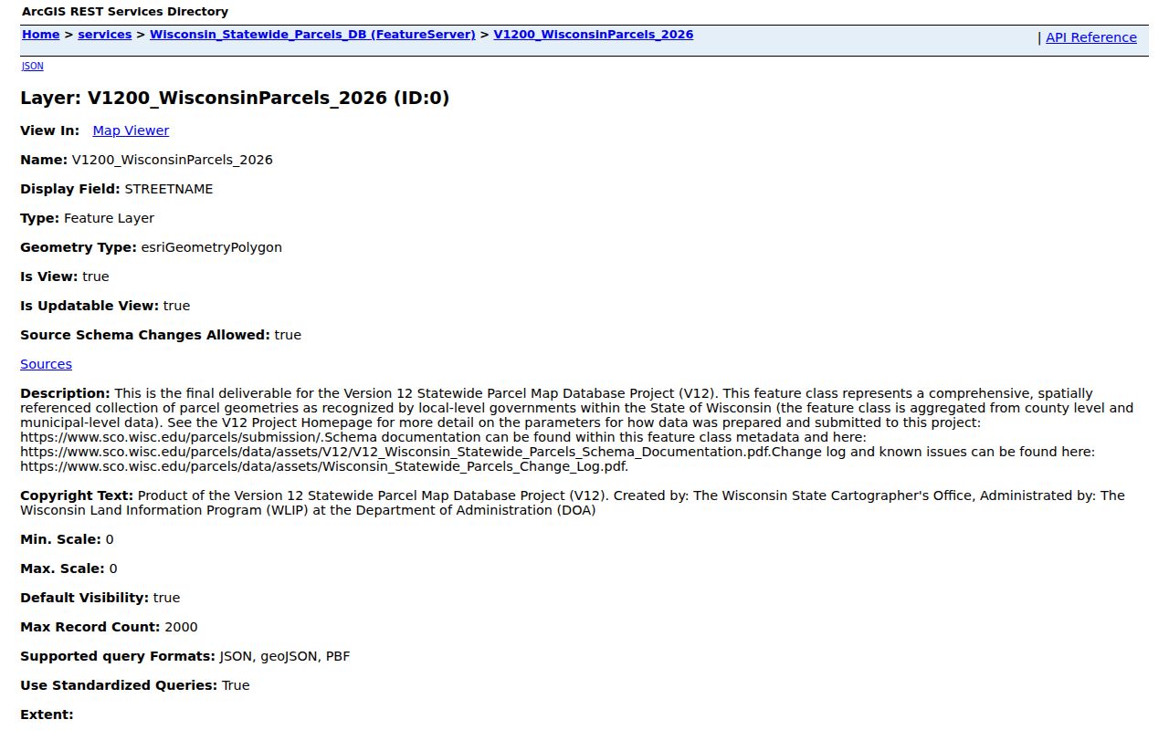
The feature-service metadata makes the address split visible: keep site location and owner's postal address as separate fields when comparing nearby Wisconsin parcels.
| Field group | What V12 can show |
|---|---|
| Identity | Wisconsin county, municipality, parcel identifier, owner name, and site address when submitted. |
| Mail and location | PSTLADDRESS is the owner's mail destination; SITEADDRESS is the physical parcel address. The two may differ. |
| Map context | Parcel geometry and optional road, zoning, flood, district, or imagery layers. Geometry is not a survey or legal boundary. |
| Next source | Local Wisconsin assessor, county land-information site, recorded plat, or Register of Deeds instrument for confirmation. |
Note: V12 is a discovery layer; confirm current values and parcel geometry with the local assessor or land-information office.
From a Wisconsin Parcel to Deeds
A street number is not always the deed index key. Start with the assessor's legal description, parcel or tax key, current owner's name, or prior document number. Find the purchase instrument, then search its grantor as a grantee in an earlier period. A grantor is the party transferring an interest; the grantee receives it. Follow the same tract or lot and block when names, street numbers, or spellings change.
Wisconsin county Register of Deeds systems vary. Counties may offer Tapestry EON for occasional searches, Laredo for subscription access, a county-hosted index, in-office terminal, digital reel, or paper and microfilm books. Tapestry EON begins with county selection, so select the correct Wisconsin county before entering a party name.
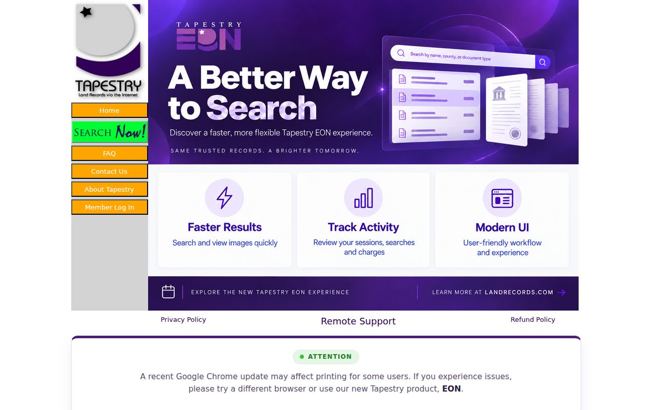
The Wisconsin county selector matters because a deed in another county will not appear in the first search. Milwaukee reports recordings from 1962 onward searchable by party, tract, or document number; deeds from 1948 onward have similar search paths, while 1835 through March 1948 deeds are located by document number or book and page. Those dates are Milwaukee's rules, not a statewide cutoff.
For Milwaukee, the Register of Deeds offers Tapestry, Laredo, a Digital Reel of city tax-assessor grantor and grantee indexes from the 1920s through 1989, and a counter at the courthouse. Tapestry may charge occasional-use fees; Milwaukee lists Laredo at $800 per month. Older books may require a counter visit, staff help, or a certified-copy request. Under Wis. Stat. §59.43, the copy baseline is $2 for the first page, $1 each added page, and $1 for certification; online image charges vary, and only the county can issue a certified copy.
A useful index result includes the parties and their roles, instrument type, recording date, document number, book and page or tract key, legal description, and image route. A deed establishes a recorded transfer; it does not name everyone who lived at the address.
- Party name and role, such as grantor or grantee.
- Instrument type and recording date.
- Document number, book and page, or tract/tax key.
- Legal description and any transfer or exemption details shown.
- Image or copy route, with certified copies requested from the county office.
Wisconsin Voter Records by Street
MyVote Wisconsin is not a public list of all voters at a street address. Its address form returns polling place, ballot, election, and absentee information for the location. The name path is an individual's record check and requires the voter's first name, last name, and birth date. The form's required street address, unit, city, and ZIP identify a specific election location, not a household roll.
Wisconsin's registration list is open for inspection, with personal data and confidential-elector fields protected. A written request to the Wisconsin Elections Commission or a county or municipal clerk can seek allowed registration fields. The state schedule lists a $25 electronic base charge, plus $5 for the first 1,000 records and each additional 1,000, up to a $12,500 maximum; paper output is 25 cents per page plus postage. Ask the custodian for current instructions. Redactions apply, and an old registration does not establish a person's present location.
A Wisconsin county or municipal clerk can also arrange local inspection during office hours. The public list may show a permitted name and registration address, but DOB, license or SSN fields, confidential-elector details, and voting accommodations stay protected.
Address, unit, municipality, and ZIP are useful to find the right polling area. Name, date of birth, status, and participation information belong to the permitted individual or official-list route. No ballot choices are public, and confidential voters remain outside the general list.
Wisconsin Permits Mark Address Events
Wisconsin building permits and code cases can help date a change at an address. Depending on the municipal record, a permit may name an applicant or contractor, describe the work, and include an issue or inspection date. A code file can contain a complaint, inspection, violation, owner or contact field, and resolution. The details and historic reach depend on the Wisconsin city, village, or town.
Some Wisconsin municipalities publish a portal; others route a request through a records custodian or building-inspection office. Madison's public-records center documents online, in-person, written, email, phone, and other request routes as a municipal example, not a statewide procedure. Open investigations, protected complainants, and personal identifiers may be withheld or redacted. These files show a work or case event, not a complete list of household members.
Wisconsin Street Directory History
Past Wisconsin directories can place a name or business at an address for a publication year. Milwaukee Public Library's local history collection describes a directory run from 1847 to the present, with address browsing from 1921 onward. Madison examples include volumes for 1871-72 and 1883-84; a 1913 Wright directory survives for Janesville. Runs vary by Wisconsin city, and gaps matter. The printed entry may abbreviate a name or occupation and does not confirm that every household member lived there.
Milwaukee Public Library's Zeidler Room page describes directory formats and its Address Change Directory holdings. Wisconsin libraries elsewhere may offer microfilm, digitized volumes, phone books, maps, or staff research help. The Wisconsin Historical Society and its regional Area Research Centers hold local government and historical material; a researcher can visit, ask staff, or request interlibrary transfer where available. More about those collections appears on the Wisconsin city directory page.
For a historic Wisconsin street, record the year, exact number, cross street, ward or rural-route notation, and abbreviation key. Compare that entry with a plat, Sanborn sheet, or address-change volume before mapping it to a current Wisconsin parcel. The 1883-84 Madison numbering rules and Milwaukee's 1930 address-change volume show why an old address string should be preserved before it is normalized.
A Wisconsin street directory search is strongest when it preserves the printed address and publication year, then explains how that entry was matched to a modern parcel.
Limits on a Wisconsin Street Lookup
A Wisconsin street directory combines records that describe parcels, official mail, election geography, and past printed addresses. It cannot reveal every person at an address. Wisconsin assessment and deed files usually identify owners and land, while voter records have restricted fields and historical directories reflect only their publication year. Utility customer names, DMV addresses, and delivery lists are not public address rolls. Some people are intentionally shielded through Safe at Home, confidential-elector, or judicial protections.
For Wisconsin results, keep the claim close to the source: “the assessor lists this owner,” “the voter lookup returns this polling place,” or “the directory printed this name at this address in that year.” For questions about one person, confirm through the custodian rather than drawing a conclusion from a map pop-up alone.
Lawful personal use. Use Wisconsin public records for legitimate research, and do not use an address trail to stalk, harass, or threaten anyone. A source's availability does not remove privacy limits or legal restrictions.